
The Edge-to-Edge Operating System for Autonomous AI.
We operate the world's largest open video driving dataset:

1.2 Billion miles of annual road coverage
60 M+ Long tail videos
350 K+ sensor network
Proprietary edge technology
Enabling us to source, structure and build the models for next-generation AV training and real-time road intelligence.
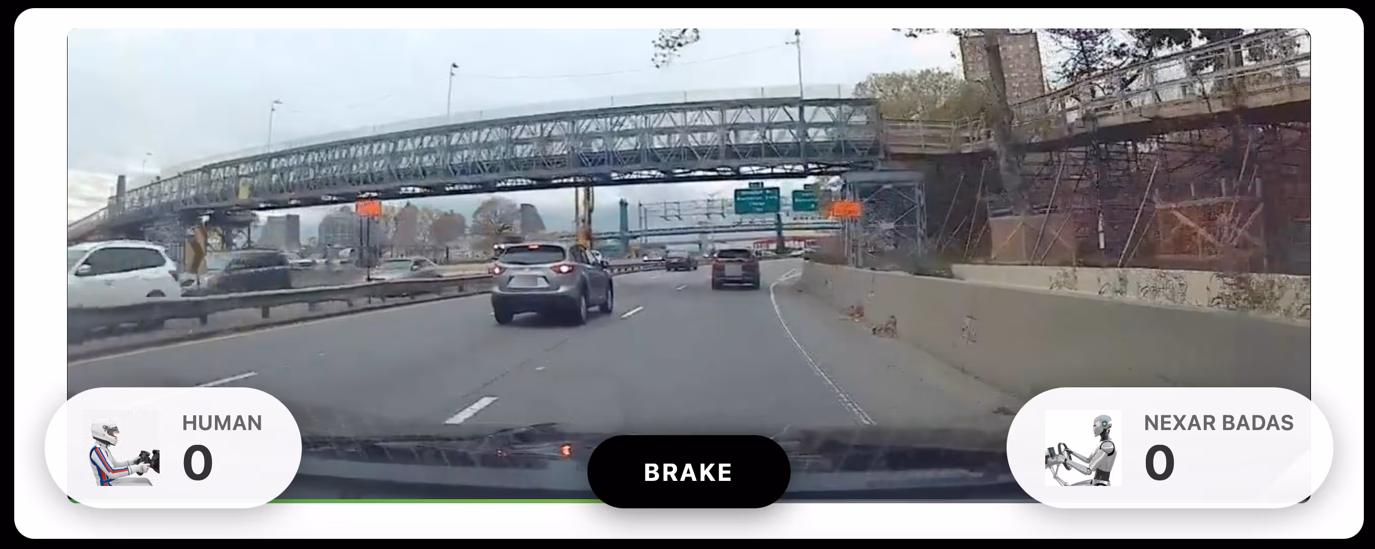
Introducing BADAS 2.0
We Just Launched The World's Best Collision Prediction Model.
BADAS 2.0 anticipates crashes before they happen - 99.4% precision, 91% early warning recall, trained on 2 million real-world driving clips. We fine-tuned NVIDIA's Cosmos on the same data. BADAS wins, at 91x fewer parameters.
Not a benchmark. A deployment.
_0003%201.avif)
.png)
.png)
.png)
Test your intuition against the BADAS model
CROWDSOURCED SENSORS.
REAL-WORLD EDGE.
Every Nexar dashcam is more than a camera, it’s a connected sensor at the edge. Together, they form a dense, always-on network that captures the real-world complexity other systems miss.
Massive Coverage: Millions of miles captured every day across diverse roads and conditions.
Edge AI Built In: Devices filter and send only the critical events.
Continuous Stream: Everyday driving becomes training fuel for tomorrow’s AI, ADAS and Robotics.
DELIVERING THE LONG TAIL. NO SIMULATION, ONLY REALITY.
Your models are only as smart as the world they've seen. Our network of AI-powered cameras captures billions of miles of authentic, unstageable driving moments, ensuring your systems master the chaos that simulators miss. We provide structured, high-fidelity video and metadata in a format usable for model training and simulation input.
Unmatched Scale and Diversity: Access over 1.2 billion visualized miles annually.
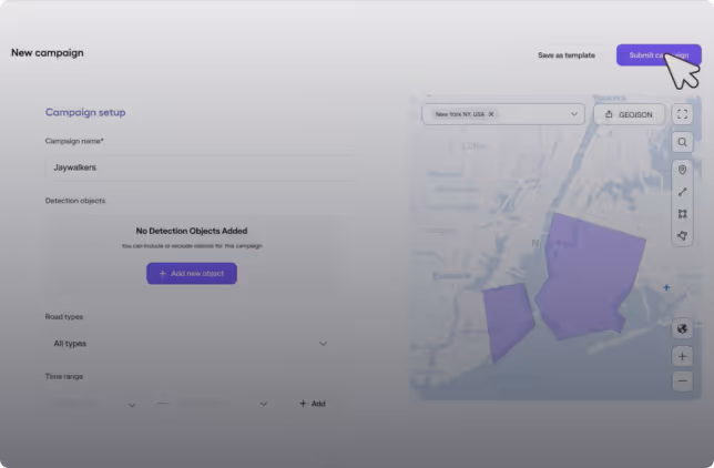
Collection On-Demand: Define the exact edge cases (by geography, weather, behavior, etc’) and we proactively target and deliver the data you need.
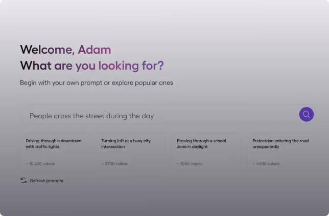
AI-Enriched Datasets: Our Enricher transforms raw footage into context-rich, annotated, AI-ready datasets, drastically reducing your team's time to research and tech breakthroughs.
MOVE UP THE STACK. FROM DATA TO DEPLOYABLE INTELLIGENCE.
We translate the complexity of our real-world road data into technical authority and breakthrough models. Our current research proves the power of this data to outperform industry benchmarks in critical safety scenarios. We are actively advancing the state-of-the-art in risk modeling and invite partners to review and leverage our findings for robust AV/ADAS validation and research.
Collision Anticipation Research: We detail the methodology behind our model, trained on our proprietary incident library, showing how it predicts collision likelihood and enables earlier anticipation than leading competitors.
Automated Scenario Reconstruction: Instantly reconstruct complex real-world collisions and near-misses into high-fidelity 3D assets for simulation input and model validation.
Safety Audit Service: Benchmark your AV or ADAS models against our curated, real-world long-tail test set to meet safety and regulatory standards.
LIVE INSIGHTS. SAFER ROADS. SMARTER FLEETS.
Our network doesn’t just collect data — it delivers intelligence back in real time. From fleets to city streets, Nexar’s edge-powered solutions close the loop between what’s happening on the road and the actions that keep people safe.
Dynamic Map Freshness: Detect new signs, hazards, and work zones in near real time to prevent map drift and improve navigation.
Smart Fleet Safety: Dual-facing, AI-connected cameras with live alerts, driver coaching, and instant collision reconstruction.
Community Protection: Support public safety with faster stolen vehicle recovery and shared roadway intelligence.
City-Scale Monitoring: Remote, street-level visibility for infrastructure planning, safety reviews, and urban optimization.
The City AV Index
How ready is your city for autonomous driving? Nexar’s AV Readiness Index measures every U.S. city through the lens of real-world driving—leveraging 10 billion miles of human driving behavior, monthly data freshness, and block-level risk signals
Simulation is a training tool. Physical Intelligence is the proving ground.
Cities change by the week — construction zones shift, friction patterns evolve, collision hotspots move. Static maps can’t keep up.
Nexar ensures each city in the Index meets our Ground Truth Threshold. And if you try to meet any other threshold, your basing off something that may not exist.
Nexar APEX: The "Driver's License" for Autonomous Vehicles
The industry’s first real-world credibility test for autonomous vehicles. Move beyond abstract simulation and validate your stack against 10 billion miles of ground-truth human driving data
Bridge the "Miles-to-Confidence" Gap: We replace theoretical assumptions with measurable, human-grounded performance standards.
The Truest Source of Truth: Anchored by Nexar’s Real-World Data Engine, capturing the full spectrum of driving behaviors that simulations miss.
Scientific Rigor: Move from theoretical safety to trusted deployment with the only open measurement for machine performance.
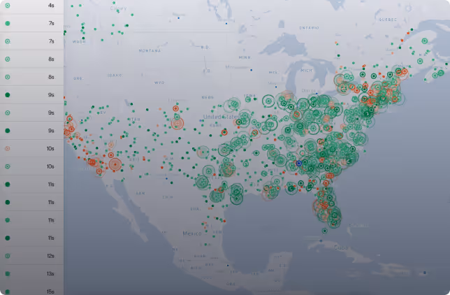
Refresh Rate Heat Map
Every city talks about mobility. Nexar shows you how fast it actually moves. This heat map visualizes the velocity of our network: how often our cameras re-see every block, every corridor, every hotspot. No model, no guesswork. Just raw, constantly refreshing ground truth.
Fresh data exposes lane shifts, work zones, and routing hazards the moment they appear.
Historical patterns reveal how corridors behave hour by hour, not just season to season.
Cross-referenced together, they turn a living map into a planning tool you can actually trust.

Edge Cases
The rare, messy, and meaningful events that define the unpredictable. We don’t simulate them, we capture them, at scale, from actual roads.
Edge Devices
A distributed network of connected dashcams, the eyes of Nexar, constantly sensing and uploading data from the physical world in real time.
Competitive Edge
A technological advantage. Our ability to mine, structure, and deliver real-world video data makes us a strategic edge for those building the future of autonomy.
Ready to access the real world?


We build tools that speak the language of your world.


AV & OEM Validation
Get ground-truth at scale. Spot edge cases, validate models, and speed up autonomy cycles.

Public Safety & DOTs
See what maps miss. Verify signs, track real-time work zones, and manage city planning with dynamic intelligence.

AI & Data Science
Train smarter. Access labeled video datasets and rare events at scale to accelerate research and reduce the cost of synthetic data generation.
Recent events
Driving Safety, Efficiency, and Trust - One Case at a Time
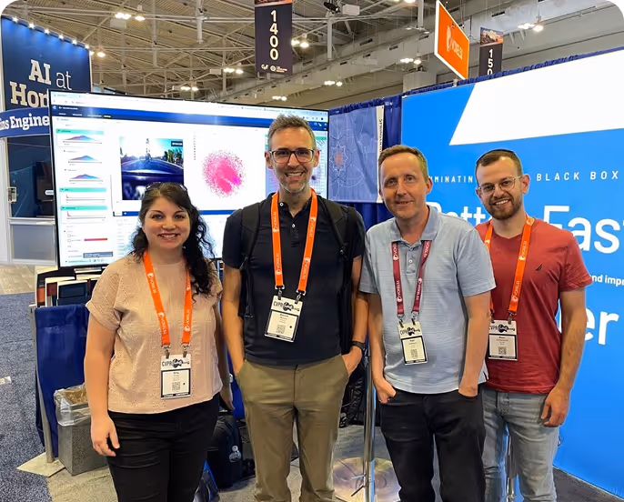
Last month, the Nexar Inc. team joined the world’s top computer...
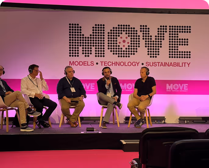
Jon Miller, Nexar’s VP of Enterprise Growth, took the keynote stage...
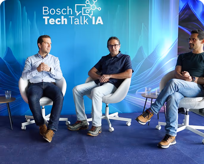
With over a decade of experience in connected vehicle...