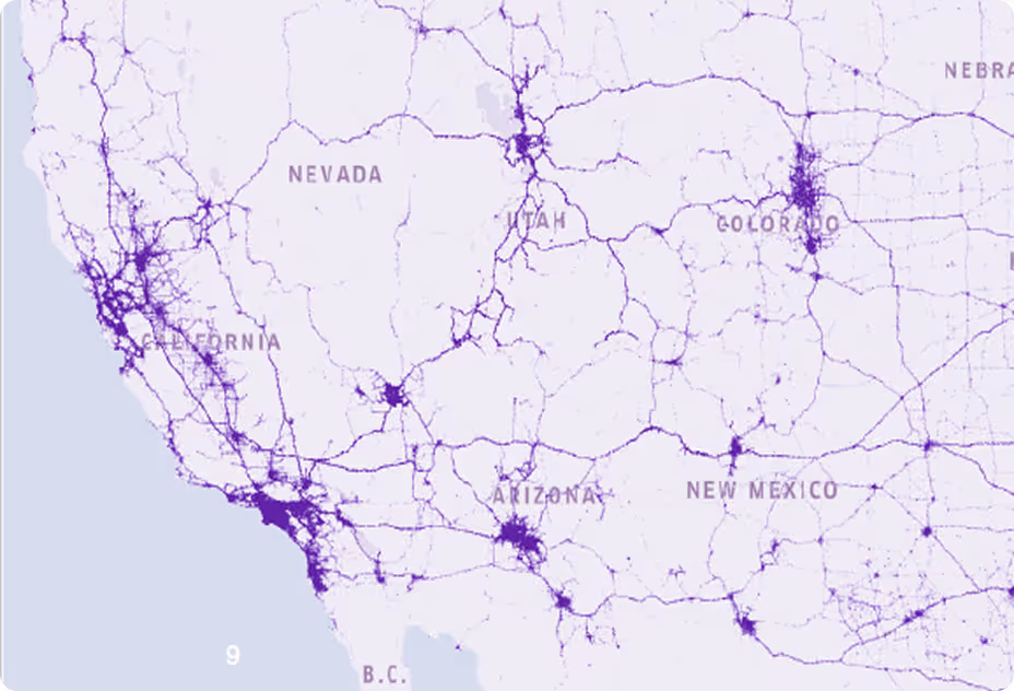
As mobility, autonomous systems, and digital infrastructure evolve, the demand for up-to-date, high-accuracy mapping has never been greater. Traditional HD mapping approaches, reliant on expensive, slow-to-update sensor fleets, struggle to keep pace with rapidly changing road conditions. This analysis presents a new paradigm in mapping where dash cams capture real-time data from hundreds of thousands of vehicles, delivering fresh mapping data at a fraction of the cost. This technology provides unmatched freshness, cost efficiency, and scalability, revolutionizing how we map the world around us.
Industry Context: The Need for a New Approach
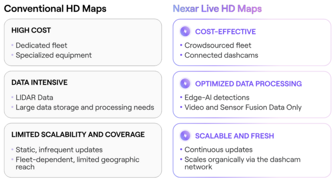
Traditional HD mapping methods face several challenges that limit their effectiveness in dynamic environments. Nexar Live
HD Maps takes a different approach, leveraging a scalable, up-to-date data collection model.
Introduction
An up-to-date map is essential to keep pace with the evolving demands of:
- Autonomous driving & ADAS – Lane-level precision and ultra-fresh road intelligence
- Smart cities & infrastructure – Dynamic urban planning and mobility insights
- Logistics & fleet management – Optimized routing and regulatory compliance
- Geospatial intelligence & telecom – High-fidelity environmental mapping for infrastructure deployment
Practical Use Case:
HD Map Creation from Dashcam Data The challenge
The main goal was to demonstrate Nexar’s ability to generate HD map assets using only its technology stack, including hardware and software components. In more detail, the challenge includes:
- Generate high-precision HD Map assets for both urban and highway road environments.
- Enhance and update third-party HD Maps with fresh road data.
- Leverage dashcam-only data to create and maintain mapping assets, eliminating the need for specialized sensor-equipped fleets.

The Data Collection
Nexar conducted a data collection campaign near Tokyo, Japan, in two distinct road environments:
Route 246 (urban corridor) and Tōmei Expressway (high-speed roadway)
- 40 km of road surveyed: 20 km per road road environment
- 277 km total distance driven: as the result of 27 passes to collect data from multiple perspectives and to minimize possible asset occlusions
- 29 hours of video processed, resulting in 3.1 million frames analyzed
- 152k frames selected, which represents 3,700 frames per reconstructed km
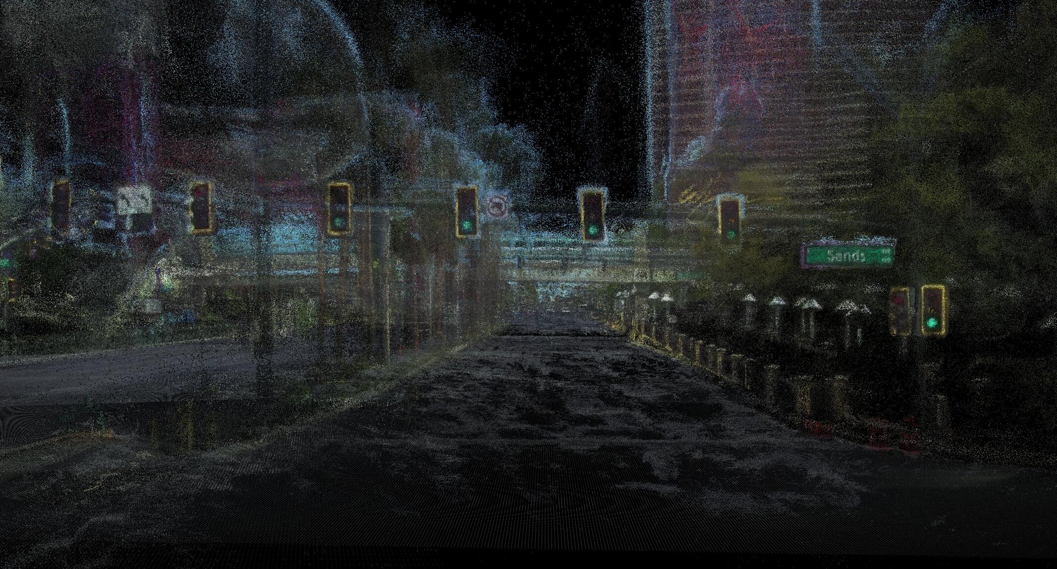
End-to-End Workflow
From Dashcam Data to HD Maps
One of the most significant challenges in mapping is detecting infrastructure changes before they impact safety, navigation, or compliance. Nexar Live HD Maps' solution detected and provided up- to-date road assets compared to a reference third-party map and known commercial solutions.
- 1,773 new road signs detected compared to a
reference third-party HD map. - 45 road signs were removed, demonstrating
automated detection of outdated information. - 2,118 traffic signs and signals were classified,
achieving a 73.2% recall compared to a reference
third-party HD map
Examples
Road Marks and Lane Lines:
- 1,172 lane and road markings mapped, compared to only 40 in the reference map
- 70% recall in road marking detection compared to a reference third-party HD map
Road Sign Change Detection Example: Removed Sign
Nexar’s solution detected a removed road sign in November 2024, which was missing from the
reference third-party map (last updated in 2021) and in 2023 by Google Street View.
Road Sign Change Detection Example: Removed Sign
This AI-driven approach instantly detected a road sign installed in November 2024, which was missing from legacy datasets—last updated in 2021 by the mapping company and in 2023 by Google Street View.
Why This Matters
The Road Ahead for HD Mapping Nexar as a Strategic Partner for HD Map Production & Update
Innovating the Future of HD Mapping
- Demonstrated scalability and completeness through multiple successful PoCs
- Advancing automated, high-fidelity HD map creation with cutting-edge technology
Comprehensive End-to-End Solution
- State-of-the-art connected cameras and AI-powered processing for accurate data collection and interference
- Crowdsource data and 3D road asset generation at scale
Ensuring HD Maps Stay Accurate & Up-to-date
- Continuous, real-time data collection from thousands of vehicles on the road
- Cost-effective, automated change detection to maintain the most up-to-date map data
The results of this analysis highlight a clear path toward the next generation of geospatial intelligence. AI-driven, crowdsourced vision- based mapping has the potential to:
- Up-to-date road data information by continuously updating maps with real-time insights
- Reduce costs and operational overhead compared to traditional sensor-fleet approaches
- Scale across road networks with vision-based, crowd-sourced intelligence
As industries increasingly demand fresher, more accurate, and cost-efficient mapping solutions, Nexar Live HD maps approach transforms how HD maps are built, maintained, and utilized.
Want to dive deeper?
Nexar helps industry leaders turn vision into value. Dive into real-world success stories where our data redefined the road ahead - and see what it can do for you.